Published July 22, 2020 07:00AM
Battery & Elevation Test: Garmin Edge 830 vs. Stages Dash vs. Wahoo Elemnt Roam
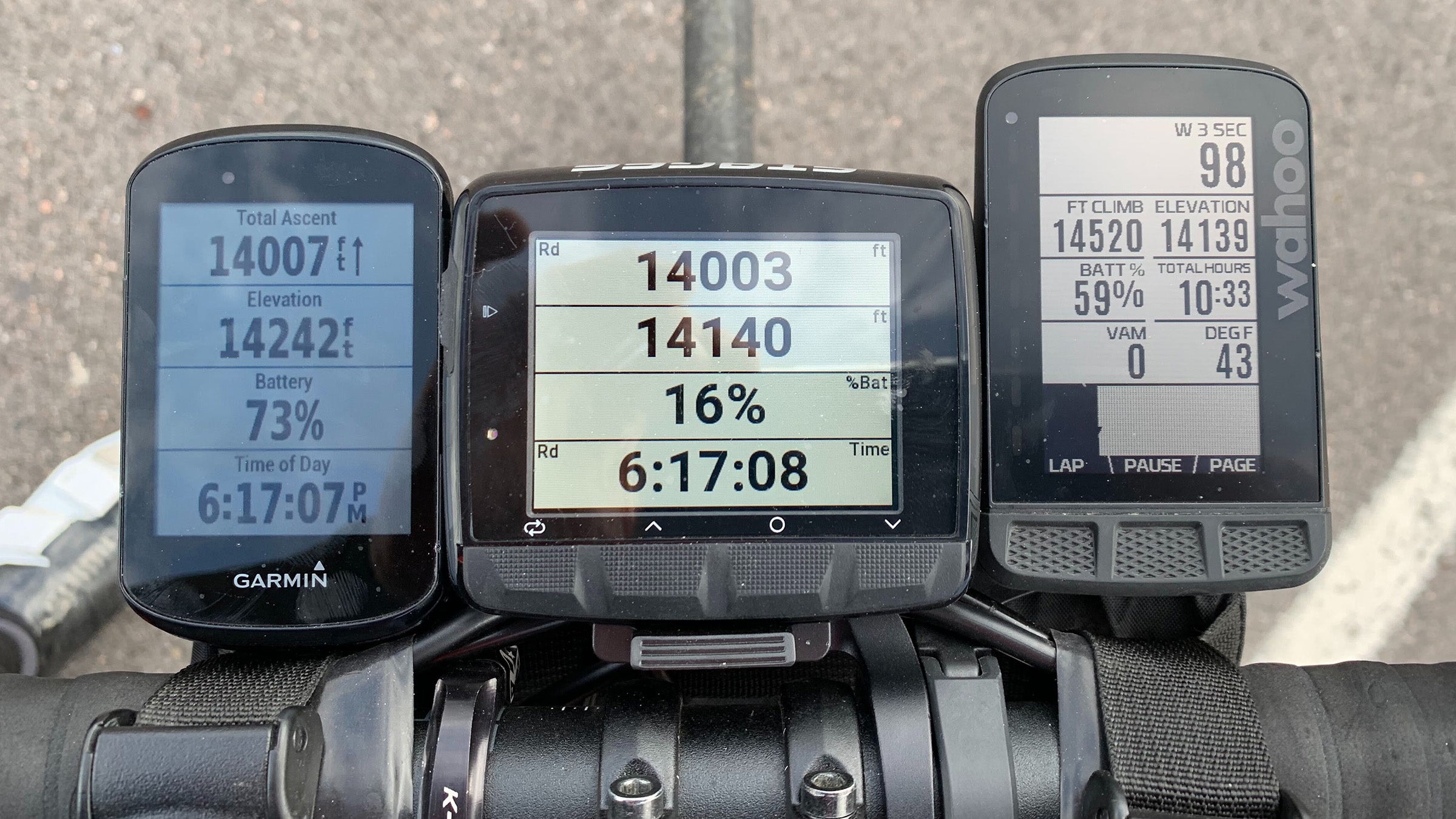
Three high-end cycling GPS computers. One 14,000-foot elevation test. Which computer came out on top?
(Photo: Ben Delaney)
If you are looking to do a big ride where elevation is important—Everesting, anyone?—what is your best bet for a cycling GPS computer? As part of the VeloNews Project 14er, I tested three computers for battery life and elevation accuracy.
The three computers in this test and their claimed battery lives were:
- Garmin Edge 830 ($399) Up to 20 hours
- Stages Dash L50 ($299) Over 11 hours
- Wahoo Elemnt Roam ($379) 17 hours
I tested them by climbing 14,000 feet with my colleague Betsy Welch, starting from a known elevation in Idaho Springs, Colorado, and riding to the top of Mount Evans—twice. While each computer has its own pros and cons, we focused just on two things in this video: battery life and elevation accuracy.

To make the battery test as apples-to-apples as possible, I standardized the computers by following a route and using power on each. For the Edge 830 and the Dash L50, I set the brightness level to auto. Battery life could have been increased on both—especially the Dash, which runs very bright—by manually lowering the brightness. The Elemnt Roam doesn’t offer any brightness adjustment, it just does it on its own.
ADVERTISEMENT
To judge elevation, I used known U.S.G.S. elevation data from the bottom and top. I consulted Strava but did not rely on it entirely. Strava is a great resource for camaraderie and ride inspiration, and the elevation data on the site is helpful but not always 100% precise. For instance, Strava Segments are based solely on the elevation recording of the single computer from the individual who created the Segment. Strava Routes, on the other hand, use a compilation of elevation data from Strava’s database.
Watch the video above to see how each computer fared.
